Revolutionising Construction with Drones and GIS: MRF Contracting’s Integrated Approach
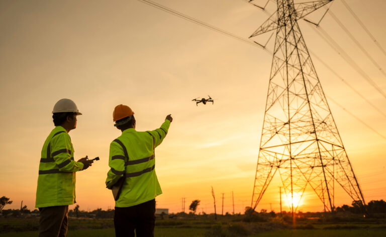
At MRF Contracting, we’re always looking for ways to combine practical field expertise with innovative technology to deliver exceptional results. One of the most powerful tools we’ve integrated into our workflow is drone technology combined with Geographic Information Systems (GIS). This approach allows us to capture high-resolution aerial data, create accurate 3D site plans, and overlay essential project details—all in one platform.
Why Use Drones and GIS in Construction?
Drone surveys provide a level of precision and efficiency that traditional methods can’t match. Within hours, we can survey large areas, identify site constraints, and create detailed models that inform every stage of a project. When this drone-captured data is combined with GIS mapping, it creates a comprehensive, interactive view of your site.
This powerful combination allows clients, contractors, and project managers to:
-
Quickly visualise site challenges and opportunities
-
Plan logistics with real-world accuracy
-
Track project progress in near-real-time
-
Minimise environmental and operational risks
What Makes MRF Contracting Different
What sets MRF Contracting apart is our ability to overlay technical project data on top of real-world site models. Our expertise in vegetation clearance, ecological mitigation, and land management means we can translate aerial data into actionable insights.
Using drones and GIS, we can show:
-
Areas for tree removal or vegetation clearance
-
Fencing plans
-
Optimal placement & calculation of temporary trackway systems
-
Silt management strategies for waterways and drainage
-
Detailed land drainage designs
-
Construction access routes and ecological protection zones
By combining field knowledge with advanced mapping technology, we deliver plans that are both visually clear and operationally practical.
Benefits for Clients and Stakeholders
-
Faster decision-making: Interactive maps help teams see the whole picture.
-
Improved safety: Remote surveys reduce time spent on hazardous terrain.
-
Cost savings: Accurate planning reduces mistakes and rework.
-
Environmental protection: Sensitive habitats can be identified and preserved.
Driving Innovation in Construction
At MRF Contracting, we believe the future of construction and infrastructure delivery lies in technology-driven planning. By pairing cutting-edge drone imagery with GIS systems, we’re providing a single source of truth for site planning—helping clients move forward with confidence.